Anna:

-
Post cards from Malnate
- About Malnate
-
The bridge
-
The churches
-
The wild animals
FESTIVALS
MALNATE

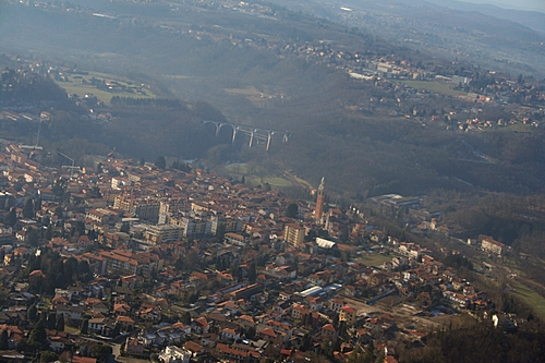
Malnate is a little town next to Varese.
It is collocated on the hills, near Prealpi mountains.
The lowest part of Malnate is the “Folla” or “Valle” village (282 m)
Here there are some water courses: the Lanza creek (northeast border), and the “Bevera” creek (northwest border).
The two creeks go in a bigger river: Olona.
An other creek is “Quadronna” that runs along the southeast border of Malnate.
The highest part of Malnate is “Morone” mountain.
Quite high is the hamlet of Rovera (379 m)
Others hamlets are: Gurone, where there is our school, and San Salvatore that is farer, near the road for Como.
Of course there is the Malnate centre too, where there are: the Town hall, several buildings, shops, banks, the Postal Office, the parish church, public gardens, schools.
There are also some restaurants and “pizzerie”.